Geodetic Control Benchmarks

View: City of Windsor Benchmark Current List
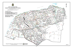
View: Vertical Geodetic Control Map with Benchmark Locations
The City of Windsor vertical geodetic control (benchmark) information is a surveyor's mark made on a stationary object of previously determined position and elevation and used as a vertical reference point for surveys and construction projects. The City of Windsor has approximately 1,600 vertical control "benchmarks." These are number markers (usually brass plaques) that could be found on private property. Please respect the property of those when using these benchmarks.
For general information, contact 311.
Or
Jelena Muegge, C.Tech.
Supervisor, Drafting
Email: jmuegge@citywindsor.ca
Phone: (519) 255-6257 ext. 6303
Fax: (519) 255-9847
